Written and photographed by Nicole Girgen
The sky was overcast on Sunday afternoon, and a light fog started to wrap around the bluffs as I drove towards my destination for the second time this weekend.
John A. Latsch State Park sits along highway 61 on the Mississippi River, roughly 20 minutes north of Winona, Minnesota.
The site was founded in 1925 when Winona businessman, and a supporter of conservation work John A. Latsch donated 350 acres to the state of Minnesota for park use. Latsch also donated land in Whitewater State Park and Perrot Sate Park in Wisconsin.
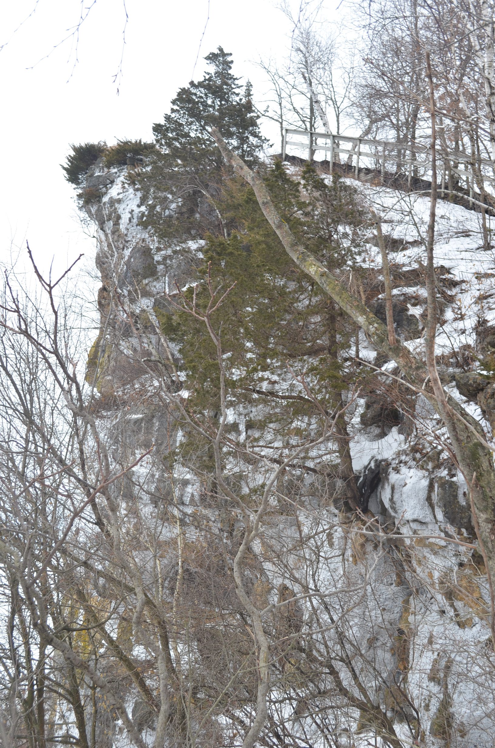
Mounts Faith, Hope and Charity are the three bluffs included in the park, named by steamboat captains in the 1850s who used these peaks as landmarks while traversing the Mississippi.
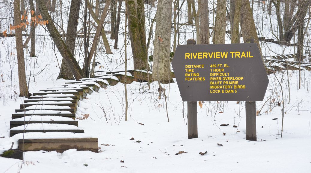
The development of the park was slow, due to the landscape the only level ground was in small ravines which separate the three bluffs. In 1933 the Mount Charity Riverview Trail was created by the Civilian Conservation Corps and remains the only developed trail in the park to this day.
An analysis of the park in 1971 recommended the area be reclassified as a scientific and natural area, no action has been taken to reclassify the area and it remains a state park.
A parking area nestled in a small clearing opens to a small picnic area at the bottom of the bluff and a short walk leads to the trailhead.
Wood steps embedded into the hill sets the path winding through the forest and up the bluff, the half-mile trail is rated difficult by the Minnesota Department of Natural Resources and not even a third of the way up it was clear why.
The entire trail rests at varying stages of an incline that gradually gets steeper the higher you go, and I was already slightly out of breath.
About half way into the hike there was a break in the steady stream of cars along the highway and the entire atmosphere of the park changed, a stillness echoed over the bluff, not a single leaf rustled in the wind and no bird calls descended from the trees.
The crunch of my boots against the snow-covered steps and the dull roar of the highway was a constant reminder of human presence in those woods, but in that moment of peaceful stillness I felt truly alone.
It was over in an instant.
The low rumble of a car just rounding the corner of the next bluff broke the stillness and, shaken from my moment, I continued to climb.
When I reached the peak, a light mist began to set in, an early sign of the coming fog I could see over the panoramic view of the ice-covered Mississippi, and as much as my legs burned from the hike up it was nothing compared to how I’d feel after the trip down.

Though the park is open all year the stairs were not cleared of snow on my trip. This was my first time on this trail in the winter and I am unsure if the trail condition is normally this way or if the recent cold snap prevent usual trail maintenance
Because of the warmer weather, melting snow and extra condensation in the air the stairs became slick and the snow covering compacted into a slippery surface.
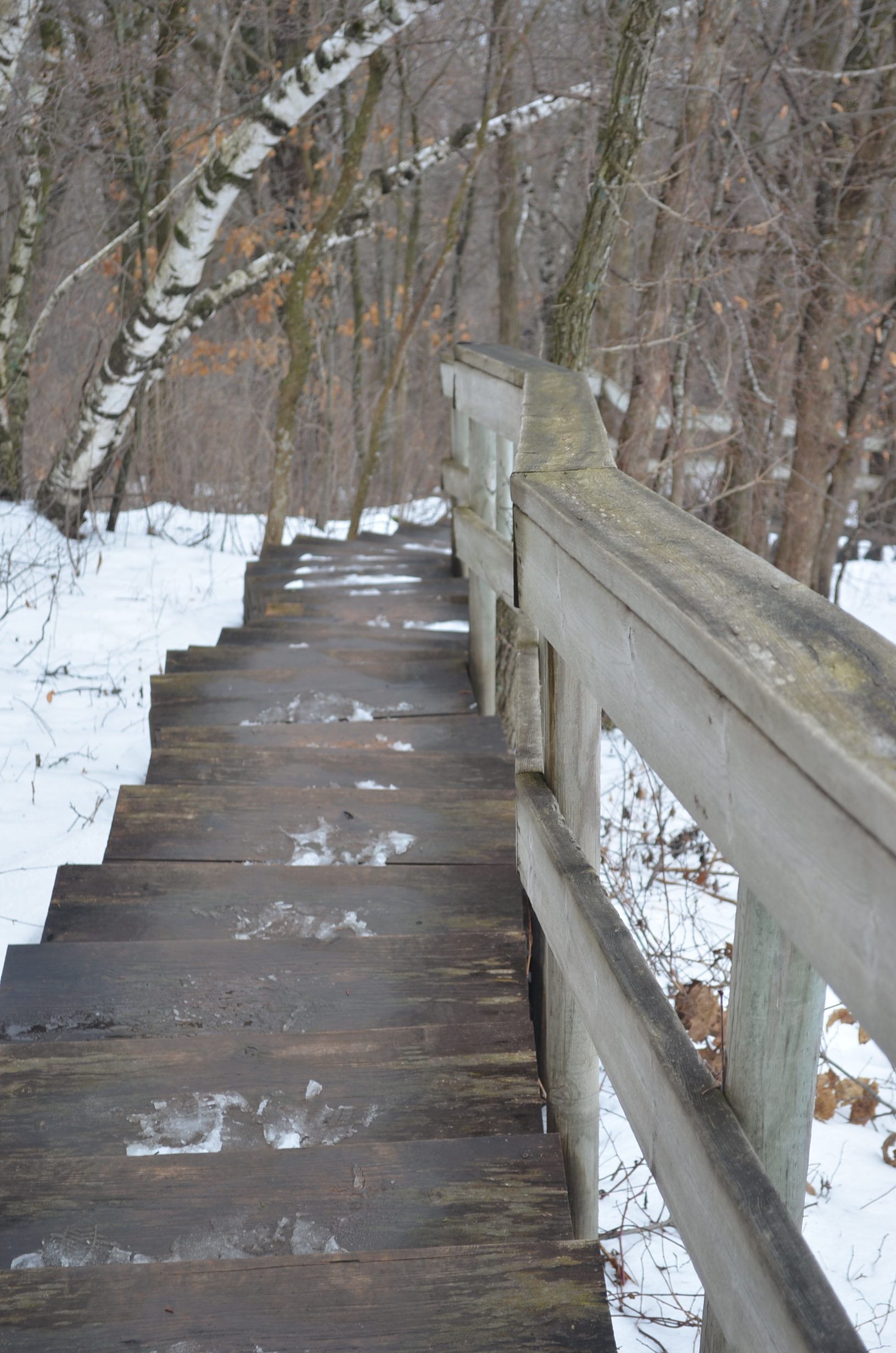
Each step was taken slowly and one at a time, foot placement was key, and I still slipped several times with one resulting in a fall. The long stretches of stairs with no railings or support also made the trip down much more difficult.
I would recommend this trail in any season, but extra precaution should be taken in the winter to avoid dangerous situations.